RESILIENCE ANALYTICS • OSONWANNE GROUP LLC
Resilience Early Warning: explainable warning for water, food and energy stability from public data
A working research prototype prepared in response to an Army Geospatial Center broad agency announcement topic on AI techniques for publicly available data. It ranks areas by risk, explains every score with its evidence, and states forecast uncertainty honestly.
Measured, not just claimed
Every number below comes from the running prototype and its own hindcast tests, using only free, keyless public data.
13
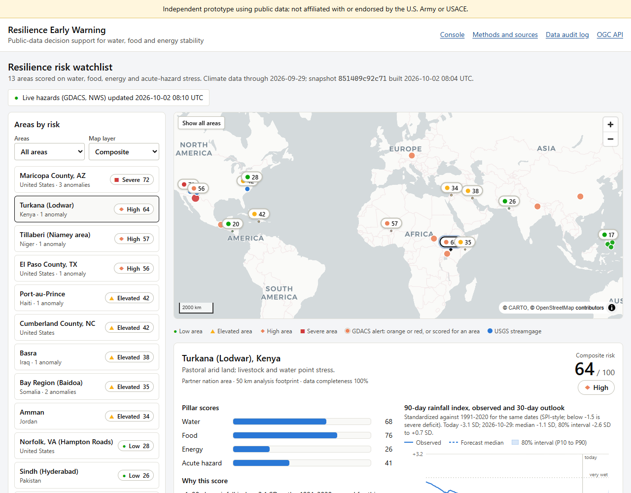
Areas scored on water, food, energy and acute-hazard stress: 9 international and 4 US communities
7
Public sources: NASA POWER, World Bank, GDACS, USGS, NOAA, U.S. Drought Monitor and FEMA
35%
Lower 30-day rainfall-index error than a no-change forecast, across 1,794 hindcasts since 2021
67→77%
Held-out coverage of the 80% forecast interval after calibration, with the remaining gap stated openly
What it does
Explainable risk scores
Each area gets water, food, energy and acute-hazard scores from stated rules. The five biggest drivers are listed as reasons, each citing its source, so a single crisis is never averaged away.
Anomaly detection
Standardized rainfall indices against the 1991–2020 normal, heat anomalies, high or low streamflow, and nearby hazard alerts flag areas that are drifting out of their normal range.
Honest 30-day outlook
An ensemble forecast gives low, median and high bands for the next 30 days, calibrated and tested on held-out hindcasts so the stated uncertainty can be trusted.
Cited analyst briefs
One click writes an analyst brief for any area in which every statement cites the data it came from. It runs in demo mode with templates, so no AI model invents anything.
Standards-based outputs
Results are served as GeoJSON and CSV and through an OGC API – Features service, so they can feed existing geospatial systems instead of standing alone.
Data audit trail
Every data pull is logged with its address, time, data currency and a fingerprint in a hash-chained log you can verify in the browser.
Who it helps
PLANNERS
Prioritize early
An auditable ranking of where stress is building, with lead time and stated confidence.
WATER AND EMERGENCY MANAGERS
Drought and flood watch
US communities are scored with USGS streamflow, Drought Monitor and FEMA risk data alongside live weather alerts.
ANALYSTS
Defensible sourcing
Every score and brief traces back to a logged, fingerprinted data pull.
PARTNERS
Shareable by design
All inputs are public, so results can be shared with humanitarian and international partners.
See it running
Explore the working prototype with no login: pick an area, read why it scored the way it did, check the 30-day outlook, generate a cited brief, or browse the data audit log.
Questions? bon@osonwanne.com • 602-632-9589
Resilience Early Warning is an independent research prototype by Osonwanne Group LLC that uses only publicly available data. It is a research demonstration, not an official assessment, and it is not affiliated with or endorsed by the U.S. Army, the U.S. Army Corps of Engineers or any agency.